Daily Image
16-06-2017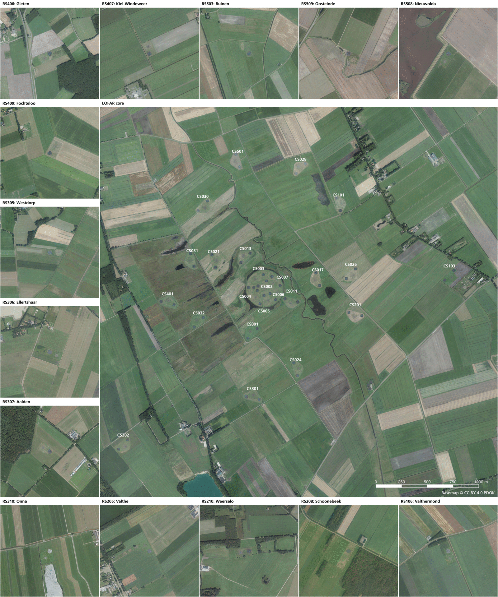
Mapping LOFAR
| Submitter: | Tammo Jan Dijkema |
| Description: | LOFAR looks best from the air. The scale is even such that sometimes the HBA tiles show up on topographical maps. I have enriched the Dutch topographical map TOP25raster with the exact positions of all LBA dipoles and HBA tiles. For comparison, I printed a recent aerial photo (which is also open data) on exactly the same scale as the topographical map. High resolution versions of this map are available for both topographical and aerial. The software used for this work is QGIS, an open source GIS program comparable to e.g. ArcGIS. The files used to create this are at https://github.com/tammojan/lofarmap. I will give a software talk on using QGIS for LOFAR on July 6. The topographical map may be used to go sightseeing all of the Dutch LOFAR stations. When doing so, please make sure not to use any RFI emitting devices such as mobile phones or cars. |
| Copyright: | CC-BY-4.0 PDOK / Tammo Jan Dijkema |
| Tweet |  |