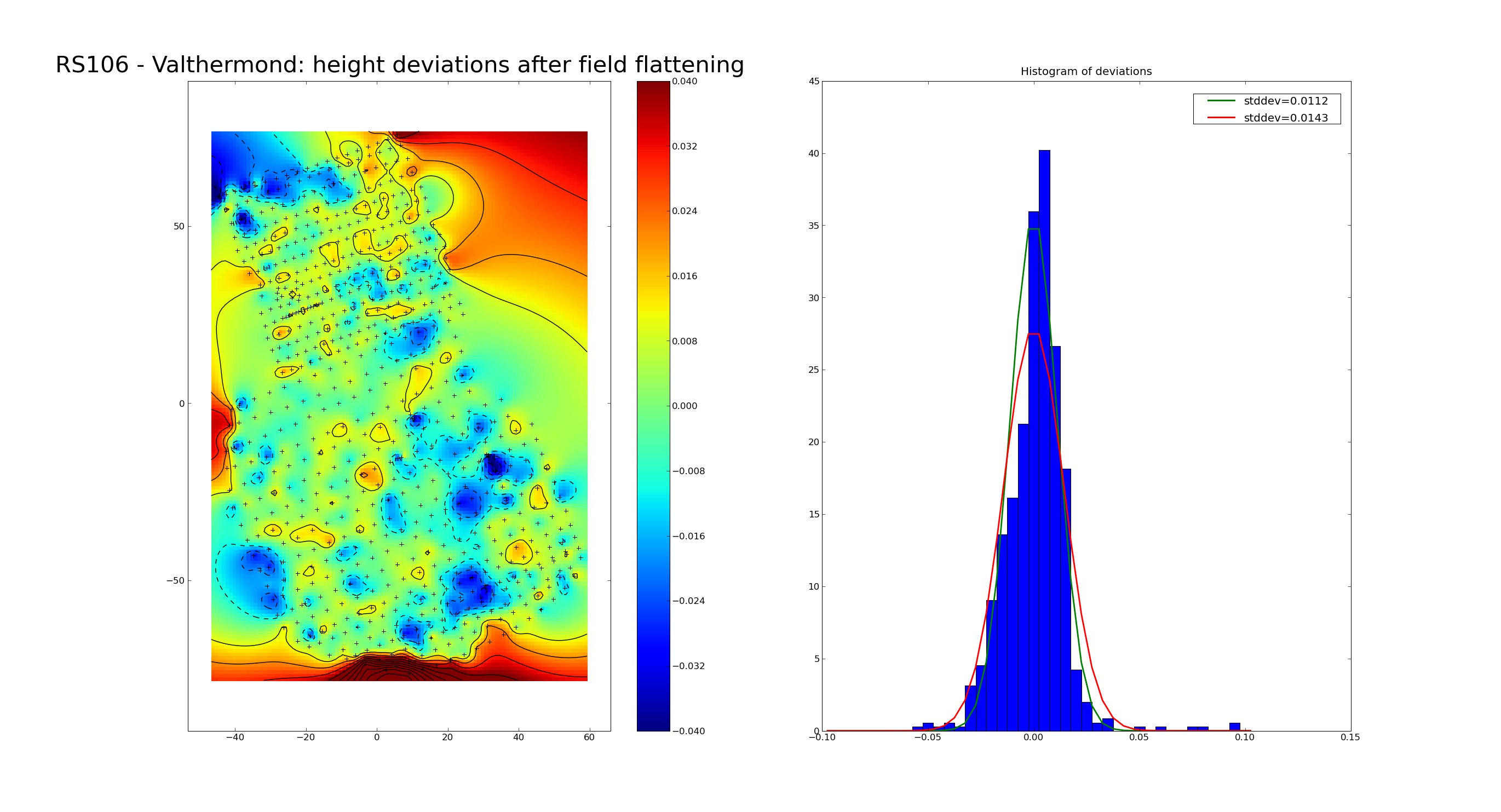
| Description: | On Monday March 2, 2009, Arie Huigen, Michiel Brentjens, Hans Konig (Azimuth BV), and "Gerard" (intern, Azimuth BV) paid a visit to LOFAR field RS106 near the metropolis of Valthermond with the aim of measuring the accuracy of its surface. Because the ground is basically our optical surface, we would like to have it flat to about 1/40th of a wavelength in order to prevent difficult-to-model distortions of the primary beam. This leads to a smoothness requirement of better than 3 cm RMS variations at the HBA field (top of image, dense sampling), and 6 cm at the LBA field (bottom of image, coarser sampling). The field had been flattened on 15 December 2008, after which it had suffered torrential downpours followed by permafrost-like conditions for almost two months. The coordinates of more than 700 points (crosses) on the surface of the field were measured in a period of approximately 2.5 hours. The results surpassed our wildest dreams. The largest deviations of up to 9 cm occur at the edges of the field, where we occasionally walked off the flattened area. The RMS of all measurements is only 14 mm. When the outliers at the edges of the field are discarded, the RMS of the deviations from the desired surface is only 11 mm! The standard deviation of the same set of points is also 11 mm, indicating that after exclusion of the points along the edge, the differences are more or less Gaussian (see right panel, where two Gaussians are plotted on top of the histogram). The only large scale structure is the "deep" valley in the LBA area with a maximum depth of the order of 3 cm. The contour lines are plotted at +/- 1, 2, 3, ... cm. The colours and contour lines show a linear radial basis function interpolation of the measurements at the crosses. The pixel size in the coloured background is 1 m. The best-fit plane through the points (after removing outliers) makes an angle of 56 arc seconds with the intended surface, which translates to a slope of 27 mm per 100 m. Not bad at all. |