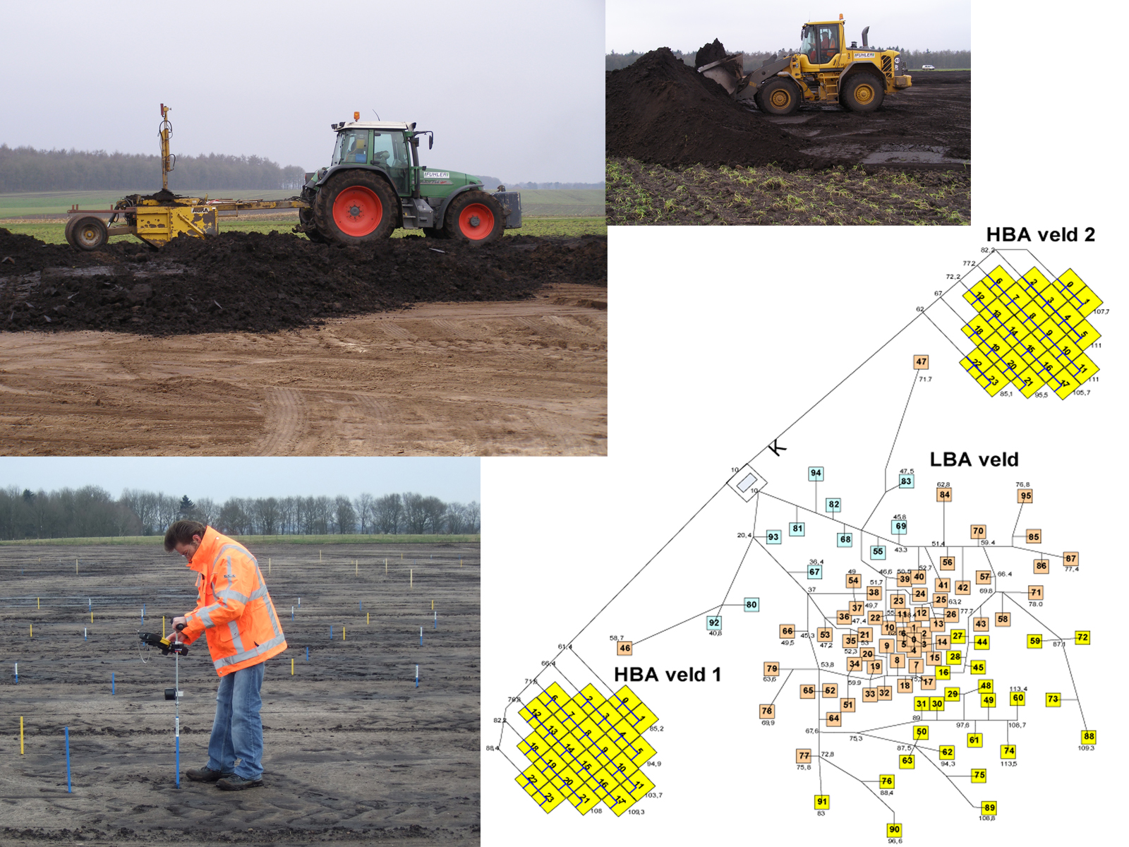
| Description: | The construction of the LOFAR stations is now well underway. Before the antennas and other equipment can be placed, a plane is defined for each station and flattened with the aid of a laser guidance system. The requirements on the flatness that needs to be achieved are quite strict (level to within +/- 6 cm for the Low Band Antenna field and +/- 3 cm for the High Band Antennas). Under normal weather conditions, this is well within the capabilities of the contractor that carries out such work. Once the field has been flattened, a geodetic engineering company sets out the positions where the antennas are to be placed and the cable paths. The technique used at this stage is referred to as total station and combines the conventional theodolite function to measure angles with an electronic distance meter. The information that is gathered with the total station is stored on an external computer, where the measurements can be easily analysed and displayed. The images shown illustrate this process. The markers that are placed on the fields are colour coded to indicate what position they denote; the various options include the location & orientation of the antennas/groundplanes, or the positions of the cable trenches. |