Daily Image
23-09-2011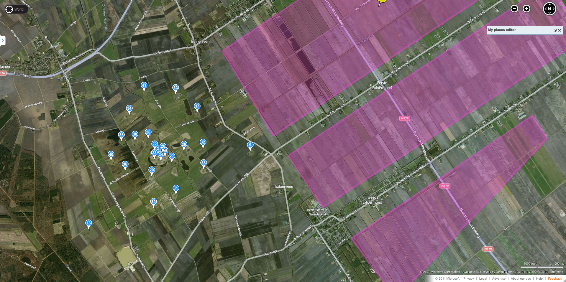
The LOFAR core and the Drentse Monden
| Submitter: | Hans van der Marel |
| Description: | The satellite pictures of Bing maps shows very nicely the LOFAR stations in the core. Just for clarity they have been indicated with a pin as well. The magenta polygons indicate the areas where the wind turbines of windfarm De Drentse Monden can be built. The exact positioning of the wind turbines is not fixed yet. Several variants will be considered in the MER (environmental impact report). CS103 (pin 9) is the closest to the planned area with a distance of just 500 meters! But also CS101 (pin 37, 1100m) and CS028 (pin 33, 1200m) are close. The distance between the superterp and the border of the windfarm planning is just 2 km. It does not require a lot of imagination to realize that a large windfarm with at least 70 wind turbines with heights up to 200 meters that close to LOFAR will have a significant impact on the astronomical observations with LOFAR. ASTRON is currently investigating at what distance from a LOFAR station and from the LOFAR core the windfarm is not causing harm to the observation and tries to establish such a clearing zone. |
| Copyright: | ASTRON |
| Tweet |  |