Daily Image
02-08-2017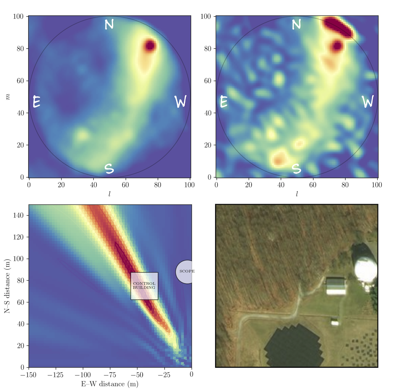
Sky and ground imaging with LOFAR LBA
| Submitter: | Vanessa Moss |
| Description: | Last week, Michiel Brentjens gave Pietro Zucca, Sander ter Veen and myself a crash course in writing our own LOFAR imagers from scratch using Python. This meant going back to the very basic steps, starting with a binary file which we recorded ourselves on each of our respective international LBA stations (DE601, SE607 and DE603) and eventually Fourier-transforming the data to reveal the sky above! The goal here was for us to try coding the key steps that are taken to go from dipole data to sky data (image: top left), which are carried out in more complicated ways by much more advanced imagers such as CASA, AIPS and MIRIAD. Michiel also showed us how to change the plane of imaging from the sky to the ground. My station (DE603, Tautenburg) conveniently happened to show some neat transient radio frequency interference (RFI) during the observations (image: top right). RFI decorrelates on international baselines, so it is not a problem for regular LOFAR observations, but it does influence calibration solutions and local station use. From the sky image, we could tell the RFI was located north-west of the LBA. By imaging a few 100m to the NW of the phase centre of DE603LBA, we were able to roughly locate the RFI to within a control building associated with the nearby optical telescope Thueringische Landessternwarte Tautenburg (image: bottom left/right). Pretty awesome that you can easily use interferometric visibility data to go RFI-hunting without needing anything other than Fourier transforms! While this was a basic exercise in interferometry, it was extremely useful (and cool!!) for us to be able to quickly image the sky/ground nearby any LOFAR LBA station. We look forward to much fun in the future with LOFAR imaging! |
| Copyright: | Vanessa Moss |
| Tweet |  |