Daily Image
25-08-2017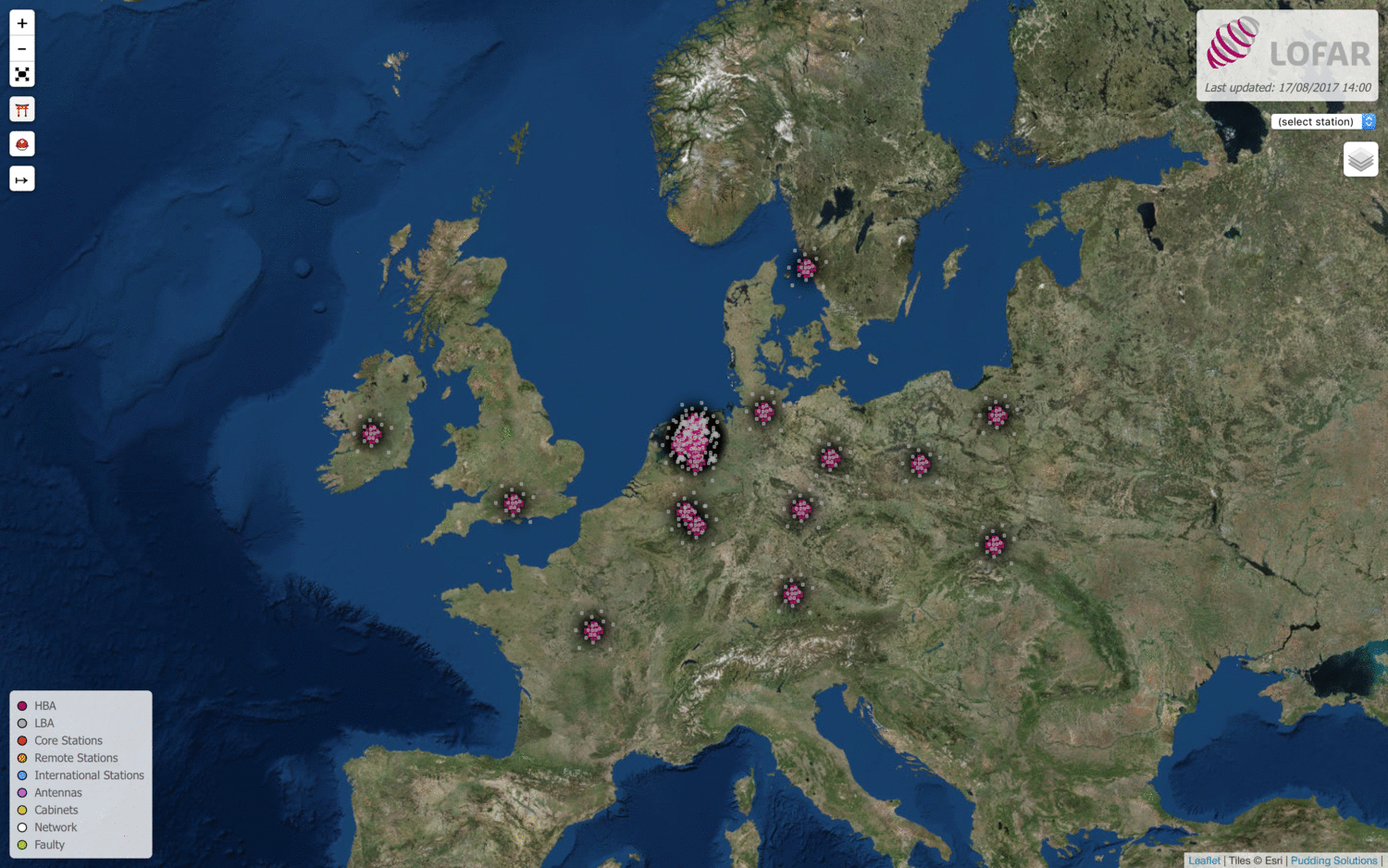
Interactive LOFAR Map
| Submitter: | Vanessa Moss |
| Description: | This interactive LOFAR map began as a learning tool that I built while attempting to become familiar with the various stations that make up LOFAR and where they are distributed across Europe (thanks to Michiel Brentjens' awesome Python database of LOFAR antenna positions). Then, as I learnt more about the system and diagnostics from various people, I added different components to the map until it grew to the current version you see here, accessible at: http://astron.nl/lofartools/lofarmap.html Layers are added via the Layers button on the right side of the map. The basic features include the positions of the HBA/LBA phase centres of each station (click to show names). You can also filter to see Core, Remote or International stations. More detailed features include the positions of each antenna/tile (coloured red if currently offline), cabinets, network pathways and possibly faulty antennas (as reported by RTSM). The drop-down menu will highlight a station if it is in the field-of-view, or if not, it will move the map so it is in the FOV. For more detailed usage, click the red-hat button or see here: http://tinyurl.com/ilm-help Google Chrome is recommended as the most stable browser, but it has also been tested on Safari, Firefox and Internet Explorer. Some versions of Firefox have issues displaying the maps, in which case I recommend trying Chrome or updating your Firefox browser. Any ideas for new features, or reports of bugs in usage, are very welcome! |
| Copyright: | V. Moss |
| Tweet |  |