Daily Image
25-05-2020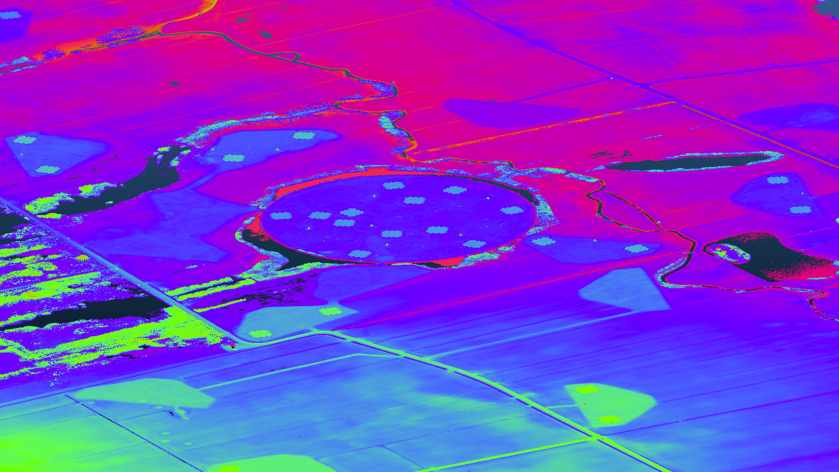
3d point cloud of the LOFAR core
| Submitter: | Tammo Jan Dijkema |
| Description: | The Actueel Hoogtebestand Nederland is a digital elevation model of The Netherlands. The model is released as open data. The model is produced with laser altimetry. The intermediate point clouds, containing centimeter accuracy, few centimeter resolution xyz data. The full data was acquired in the period 2012 - 2019. Using several scripts (available here I downloaded sheets C_17FN1 and C_17FN2 of the survey, and visualized them using the tool CloudCompare, encoding the height in the color. The point cloud for this image is about 300MB and available on request. The image shows the super terp, some core stations, the concentrator node and also the terrain for six stations that were planned but never built. Apart from making interesting visualizations, the point clouds, or the derived elevation and terrain models, should be interesting for analyzing the current position of LOFAR, or for use in propagation models. |
| Copyright: | CC-BY-4.0 Tammo Jan Dijkema |
| Tweet |  |