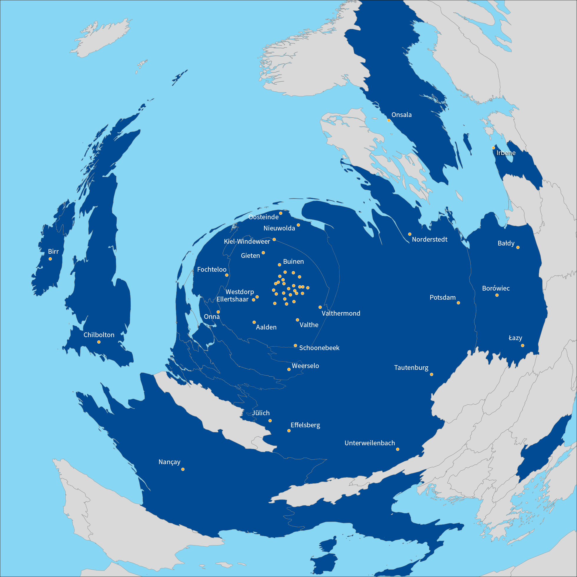
| Description: | The map was made by projecting all coordinates onto the plane of the superterp, centered on the center of CS002 LBA. In that projection, the vertical component (which is orthogonal to the screen in this map) varies from +10m for CS302 to -78km for the Irish station IE613 and -91km for the Latvian station LV614. This is obviously related to the curvature of the Earth.
I introduced a radial distortion (by r^0.4) to be able to see the stations in the core individually. This may well be the first map of Europe where the name of Kiel-Windeweer is spelled out. |