Daily Image
10-01-2020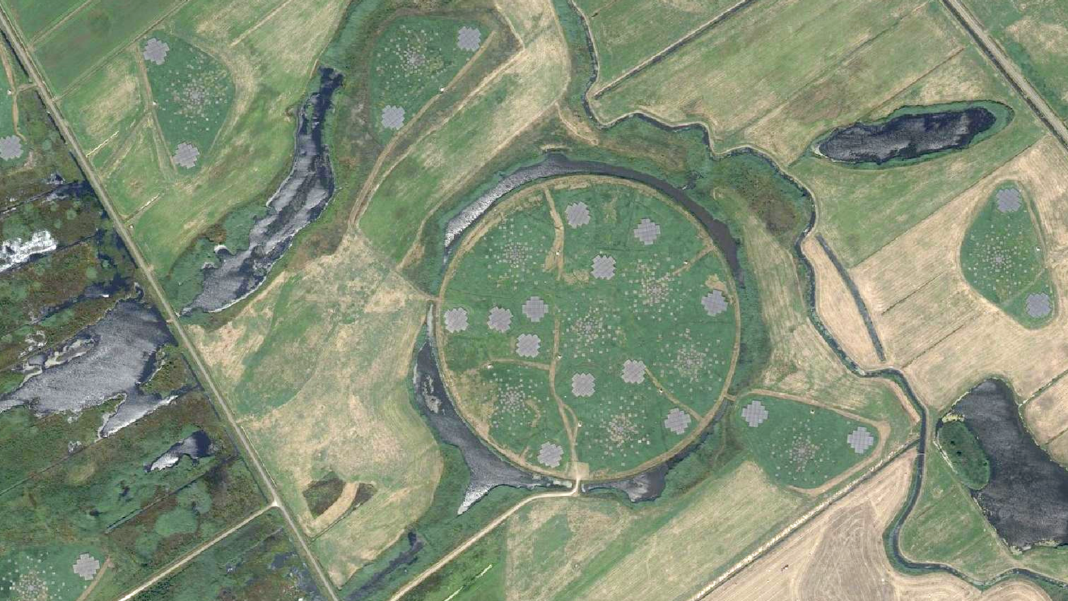
New aerial picture of superterp
| Submitter: | Tammo Jan Dijkema |
| Description: | The Dutch Kadaster (Cadastre, Land Registry and Mapping Agency) creates a new aerial photograph of The Netherlands every year. The map for 2019 turned out quite good, since the superterp whas photographed on a sunny day, somewhere around March 2019. Apart from being nice desktop backgrounds, these photos could help in validating antenna positions and assessing the state of some antennas. The maps are published as part of PDOK ("Publieke data op de kaart") and are available in various forms - such as WMS - under a CC-BY 4.0 license. It can be viewed online for the whole of The Netherlands at PDOK viewer: choose 'Selecteer een dataset', add 'Overige kaarten / Luchtfoto's / Luchtfoto (25cm) 2019'. |
| Copyright: | CC-BY-4.0 Nationaal Georegister |
| Tweet |  |