Daily Image
05-03-2021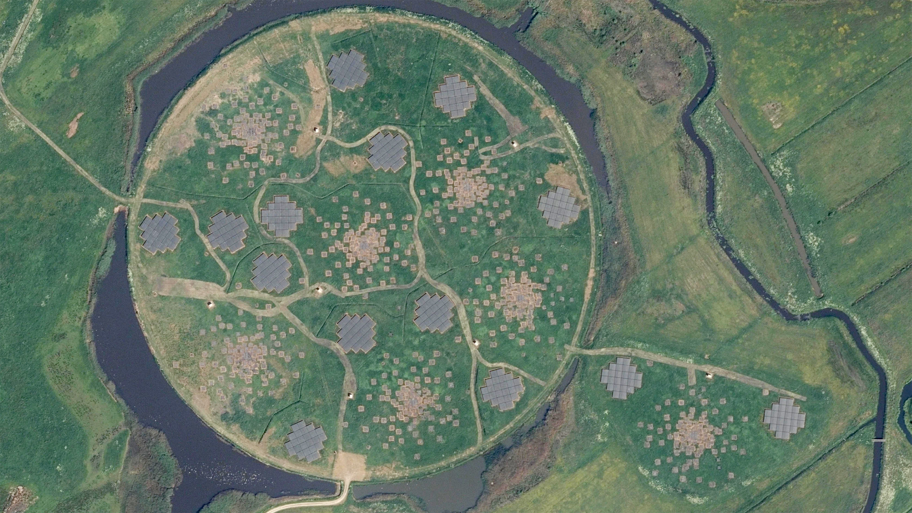
New aerial picture of superterp
| Submitter: | Tammo Jan Dijkema |
| Description: | The Dutch Kadaster (Cadastre, Land Registry and Mapping Agency) creates a new aerial photograph of The Netherlands every year, as noted before. This image shows an extract of the superterp at 10cm resolution. The maps are published as part of PDOK ("Publieke data op de kaart") and are available in various forms - such as WMS - under a CC-BY 4.0 license. They can be viewed online for the whole of The Netherlands at PDOK viewer: choose 'Selecteer een dataset', add 'Overige kaarten / Luchtfoto's / Luchtfoto (25cm) 2020'. The 2020 map is not available there yet, I used QGIS with the PDOK plugin to get direct access to the underlying WMTS server. Apart from being nice desktop backgrounds, these photos could help in validating antenna positions and assessing the state of some antennas. The orthophotos are of high quality and the positions should be accurate to a few cm. |
| Copyright: | CC-BY-4.0 Nationaal Georegister |
| Tweet |  |