Daily Image
02-02-2022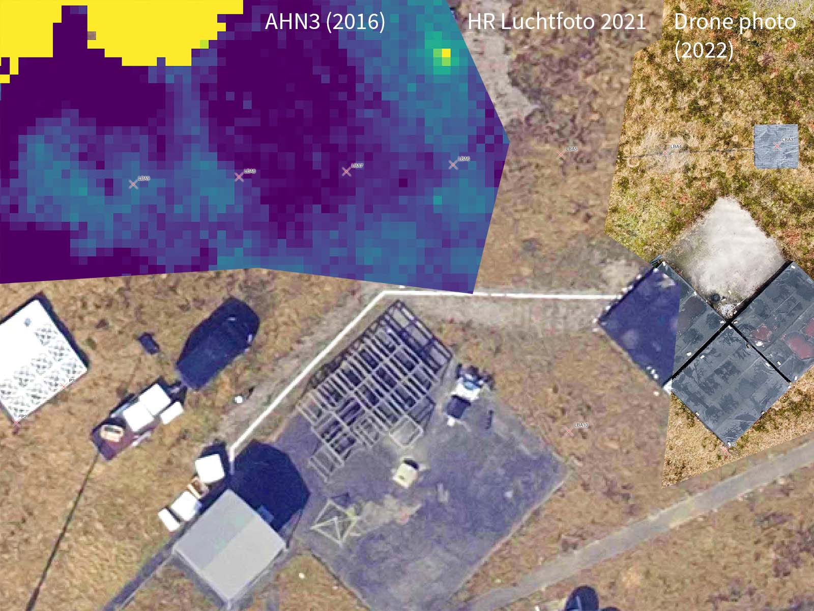
Getting LOFAR coordinates from the air
| Submitter: | Tammo Jan Dijkema, Merijn Mertens, Mark Ruiter |
| Description: | To test the Dwingeloo Test Station on astronomical sources, the coordinates of all antennas need to be known. Usually, these coordinates are computed beforehand, but since this is a test station, the antennas were just put on the field. Also since this is a test station, the coordinates do not have to be as accurate as those in a production LOFAR field. A measurement with a simple GPS device quickly revealed that this did really not provide enough accuracy: points were obviously meters off. Instead of bringing in a land surveyor, as is done for production fields, we decided to use some recent high-resolution public data sets. The High resolution aerial photo 2021 was taken in 2021, has 7.5cm resolution, and is georeferenced, so actual coordinates on Earth can be derived to few cm precision from the pixel coordinates. The AHN3 height map was released in 2021, the data was acquired between 2016 and 2020 (the plane flew above Dwingeloo in 2016). This height map contains few cm accuracy height measurements on a grid of 0.5x0.5m. The HBA tiles were already on the field when the aerial photo was taken, so it was easy to get their coordiates. But we still needed the location of the LBA antennas and the other HBA tile. To acquire these, Merijn flew his drone over the test field on 27 January, and took a picture which also included some reference points visible on the aerial photo. We used these to project the drone photo onto the map, all using the QGIS software. Finally, we converted all coordinates from the Dutch coordinate system (Rijksdriehoeksmeting + NAP for height) to ETRS89 as required by LOFAR by using RDNAPTRANS18. All in all, we think this gets the antenna coordinates to about a dm precision in x, y and z direction, where the relative error between the antennas is probably less. The nicest bit of this whole exercise is that it took less than a week from idea to execution, so that now the DTS team can continue with coordinates. |
| Copyright: | CC-BY 4.0 Tammo Jan Dijkema, PDOK, Kadaster |
| Tweet |  |