Daily Image
10-09-2024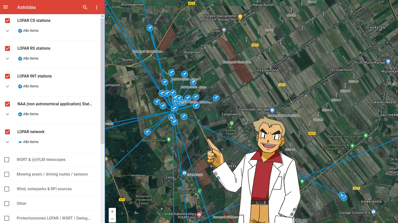
Astródex
| Submitter: | Henk Mulder |
| Description: | Welcome to the wonderful world of Astron! There are many things to discover on your travels, for instance (e)VLBI and LOFAR. This map was made to help you find anything you might need in your daily work. Have you every wondered, when you have to go to a LOFAR station or NAA cabinet.. How do you even reach the site, and when you reach the location how do I get to the cabinet? Or what bottleneck is causing my network problems, as I see multiple stations down? Some stations are interconnected, so if one station losses power and the network goes down, it is not just one station you miss in your baseline.. But it could also be a common provider, or network location (which you can also see in the map). It also shows how large the telescope really is for tours or to help explain LOFAR to guests. I found we had many loose maps, on websites, in tools some only on paper or PDF. So to make sure we have everything in one place and we can actually combine that information, without having loads of tabs open in a browser. I set out making one big combined map. Here you can simply toggle anything you need on the left of the map.. for instance (possible) RFI sources like windmills (with the owner and windmill ID), solar-parks, the Smilde tower and then activate the protection zones field. Or you are out there in the tall grass, looking for infra-sensors or one of the street power cabinets, its got you covered. And when you want a less cluttered view you simply turn off the filters you are not interested in. In our daily Operational work we found many cases we have to search for locations,and the old LOFAR map did not give us this ability. And we also needed loads more information displayed. When talking about LOFAR station some people use the LOFAR ID, others the Location/Name of the station, but in a lot of cases.. a farmer standing in his field and finds an HBA tile cover, or we get a call there is going to be digging work. We simply get a street-name or address, and that is where this map can help out a lot. And of-course the best part, we can manage it ourselves, so any great idea you have for it, information you miss or need on the map can be put in straight away. It can be opened in Google maps (for easy navigation), or in Google Earth, and files can be exported and imported in KML/KMZ/CSV (which is easily converted in JSON) for future use, like combining problems found in LOFAR observation data with known RFI sources, or other ideas we might get in the future.. To make sure it does not go viral online, I put the links on Confluence: https://support.astron.nl/confluence/pages/viewpage.action?pageId=177966889 |
| Copyright: | Henk Mulder, Willem Brouwer, Tammo Jan Dijkema |
| Tweet |  |